After many years of gallivanting, grazing, and 4-wheeling in an area of the Coral Pink Sand Dunes about the size of a football field, all of a sudden - dinosaur tracks are seen! The BLM has recognized this very special area and has blocked off the normally traveled area to preserve the tracks of ancient reptiles that once roamed the planet we live upon.
Photo Album:Dinosaur Track Pictures Day Hike: Yes Distance: Half mile Average Hiking Time: 2 hours Difficulty: Easy. Trailhead: Coral Pink Sand Dunes Visitor Center Trailend: Same as trailhead. Trail Access: Year-round, but the dirt road could be hard to travel if there is rain or melting snow. Off the Beaten Path: yes Best Season: Year-round.
Directions - The new discovery tracks are easy to get to from the Coral Pink Sand Dunes Visitor Center. Set your odometer and drive 3.5 miles south on the paved road, headed toward Cane Beds. After driving 3.5 miles, turn left at the dirt road you will see at that point. Stay on the most traveled dirt and sand road (4WD required) for 2 miles until you arrive at the wooden barrier fashioned by the BLM. Park and walk into the slickrock bowl. Look for dinosaur tracks immediately after passing the fence, but the majority are found on the right side as the slickrock wash as it begins to open. If it is winter be careful of the ice that forms in the ditch just past the fence. Have fun but remember to tread lightly! Do not step upon the tracks left from millions of years past.
Track Information - The site is located on the Utah - Arizona state line on a ridge of Moccasin Mountain at the Coral Pink Sand Dunes State Park. The tracks and location have lead, Alan Titus Ph.D. and GSENM Paleontologist in his preliminary report for the Moccasin Mountain Track Site, to conclude that they were made in the early Jurassic (180 - 190 million years ago) and also some of the Mesozoic Era (dinosaur age). He identified six different track types. If you visit the site you will find 6 various types. The smaller four appear to made by tridactyl theropods. The larger tracks seem to have been made by large ceratosaur carnivores similar to Dilophosaurus.
White rings - You will see the rings around some Dilophosauripus type tracks, which was caused by vandalism as amateurs attempted to mold the tracks. Treat these preserved raised-relief tracks at the Coral Pink Sand Dunes as you would a precious artifact in a museum.
GPS Coordinates WGS84 Datum
Turn off from Dunes Road
37°01.464 N
112°47.635 W
Parking
37°00.168 N
112°48.750 W
Dinosaur Tracks
37°00.165 N
112°48.834 W
Directions to the Coral Pink Sand Dunes State Park Plan your Coral Pink Sand Dunes Vacation with our
Utah Maps and Information
Coral Pink Sand Dunes from Zion National Park
From Zion National Park. Exit Zion Park through the east entrance and drive 12 miles to the junction U-9 & US-89. This is Mount Carmel Junction. Turn south on US-89. Turn-off to the sand dunes 3 miles from Mt. Carmel Junction. Follow Yellow Jacket road for 8 miles to the Coral Pink Sand Dunes State Park. Lodging for Coral Pink Sand Dunes
Coral Pink Sand Dunes from
Utah Highway 59 & Arizona 389
From Hurricane, Utah take Utah 59 to Arizona 389 just past Colorado City look for the road leading to the Coral Pink Sand Dunes. It will come out 3 miles from Mt. Carmel Junction, Utah. Do not travel through the dunes when it's been raining or the roads are wet from snow.
Coral Pink Sand Dunes through Fredonia, Arizona
From Hurricane, Utah take Utah 59 to Arizona 389 and travel to Fredonia, Arizona, then to Kanab, Utah. Drive on US Highway toward Mt. Carmel Junction, turning at the signed entranced to the Coral Pink Sand Dunes.
Lodging and services are available on the gorgeous east side of Zion National Park, where guests are close to Zion National Park (12 miles), Bryce Canyon National Park (60 miles), Cedar Breaks National Monument (45 miles), Coral Pink Sand Dunes (12 miles), and the North Rim of the Grand Canyon (85 miles). It's where city traffic is absent and the skies are bright and clean.
Mileage from
Mt. Carmel Jct.
Zion National Park 12
Bryce Canyon 60
Grand Canyon 85
Cedar Breaks 45
Grand Staircase 9
Dixie Forest 22
Sand Dunes 11
Coyote Butte 57
Red Canyon 47
Tuweep 90
Stay in the heart of the parks, Mount Carmel Junction, and visit the treasures of the Southwest and Utah.
This is my new favorite quote:
"I don't know who Mary Cisneros is, but I mean zionnational-park.com
It's a better site than the NPS's anyway."
Written by the authors of the book: Favorite Hikes in and around Zion National Park


 Track Information - The site is located on the Utah - Arizona state line on a ridge of Moccasin Mountain at the Coral Pink Sand Dunes State Park. The tracks and location have lead, Alan Titus Ph.D. and GSENM Paleontologist in his preliminary report for the Moccasin Mountain Track Site, to conclude that they were made in the early Jurassic (180 - 190 million years ago) and also some of the Mesozoic Era (dinosaur age). He identified six different track types. If you visit the site you will find 6 various types. The smaller four appear to made by tridactyl theropods. The larger tracks seem to have been made by large ceratosaur carnivores similar to Dilophosaurus.
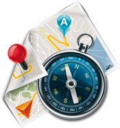 White rings - You will see the rings around some Dilophosauripus type tracks, which was caused by vandalism as amateurs attempted to mold the tracks. Treat these preserved raised-relief tracks at the Coral Pink Sand Dunes as you would a precious artifact in a museum.

