|
|
 |
|||
|
Bryce Canyon Lodge & Camp Bryce Info Vacation Photos Hike Backpack Map SR-12 Area weather |
||||

Bryce Canyon Vacation
Bryce Canyon is open year-round
2nd day Itinerary for the Southwest Vacation Experience the Incredible "Canyon Country " Tour Tour: Day 1 | Day 2 | Day 3 | Day 4 | Day 5 | Day 6 | Day 7
Red Canyon Recreation Area - Dixie National Forest
Suggested Bryce Canyon Trails
Mossy Cave - Mossy Cave is a unique trail offering a different perspective of Bryce Canyon than the other hikes in the park. This hike is an easy one, with little elevation change, that leads to a desert waterfall and a little alcove (cave) carved in a red rock cliff. The trailhead is located in a non-fee area of Bryce Canyon. Drive past the entrance to the park, then keep going north toward Tropic. There is a small trailhead sign on the right, just off the highway. Queens Garden Trail & Navajo Loop Trail - The Queens Garden Trail is 1.6 miles/2.6km round trip. This short trail is considered to be the least difficult trail going under the rim. Begin at Sunrise Point and follow the trail down below the rim. Take the option to combine with the Navajo Loop Trail. The Navajo Loop Trail is a 1.3/2km mile round trip. Wall Street, experienced along the trail, is fun as its narrow walls close in. The large hoodoo, Thor's Hammer, is an interesting site along the path. Towering Douglas Firs reach through the narrow walls for sunlight. This hike is considered to be a moderately difficult loop due to the steep return at the very end.
The 11 mile Rim Trail connects many of the parks scenic view points. This is a great way to see the amphitheaters from all different angles. Begin at Fairyland Point and follow the path, walking towards Bryce Point which is the end of the trail. There are a few more scenic view points in the park that should not be missed. These are located along the parks scenic drive. When entering the park, the Bryce Canyon Visitor Center is seen immediately. Follow the road past the visitor center, for 18 miles to Yovimpa and Rainbow Points. The next view points are Black Birch Canyon Overlook, Ponderosa Canyon Overlook, Agua Canyon Overlook, Natural Bridge and Farview Point. When at Farview Point look for a dirt path. This path leads north to Piracy Point, Swamp Canyon. Follow the spur road here to 3 more viewpoints: Paria View, Bryce Point and the Bryce Amphitheater. Return back to the main road and stop at Inspiration Point, which is perhaps the nicest view in Bryce Canyon. If Sunrise and Sunset Points were missed when hiking, then be sure to stop at them on the scenic drive. The free shuttle is voluntary in Bryce Canyon and riding the shuttle can make it a breeze to jump from point to point. Best Bets for the Adventurous Traveler: Under the Rim Trail: 23 mile round trip. This is a moderately strenuous and remote backpack. Begin the hike at the Bryce Point Overlook. Fairyland Loop Trail: 8.5 mile round trip. Begin this strenuous hike at Fairyland Point or north of Sunrise Point. The Fairyland Loop Trail descends more than 900' joining the Rim Trail to make a loop. This is a great hike to take for viewing a variety of hoodoo formations. Getting ready for Day 3 - Spend the night in Mount Carmel Junction, a 60 mile drive from Bryce Canyon and 47 miles from Red Canyon. In the morning prepare for a trip to Cedar Mountain to visit the Cedar Breaks National Monument and Dixie National Forest.
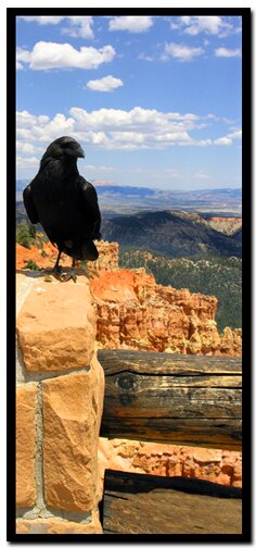
Bryce Canyon National Park, Utah |
East Zion Lodge Mileage from Stay in the heart of the parks, Mount Carmel Junction, and visit the treasures of the Southwest and Utah. Site Map Bryce Canyon History
|
||||||||||||
|
This is my new favorite quote:
"I don't know who Mary Cisneros is, but I mean zionnational-park.com It's a better site than the NPS's anyway." Written by the authors of the book: Favorite Hikes in and around Zion National Park Contact Mary to report errors: |
|||||||||||||

 Next Stop:


|
Zion History |
|---|
All rights reserved © Copyright Zion National-Park dot com
Do not use text, photos or maps without permission © Zion National-Park dot com
Contact the Author Mary Cisneros