Zion National Park Hiking Trails 
Most of the trails on this page are located along and around the Zion-Mt. Carmel Highway and the others are on the Southern end of the park rather than in Zion Canyon. The east side of Zion is where some of the parks best hikes begin such as: Zion Narrows, East Rim and Bridge Mountain. There are also several easier trails that are off-beaten-path. The most traveled trail outside of Zion Canon is the Canyon overlook Trail. At one time the east side of the park was a great sand dunes, which over time was covered by sea. Calcium carbonate "cemented" the grains of sand creating the Navajo Sandstone Layer you see today. The east side of Zion is now known as slickrock country. Slickrock is red sandstone that is lacking large concentrations of iron oxide. Thus these buttes and domes are the more easily eroded rock forms. The rock does not appear slick. In fact, it is rough and has a loose layer of sand on the surface.
 Photos: Mary Cisneros is the author of the zionnational-park.com site and Bo Beck and Tanya together have wrote the trails on this site. We have also finished a book for hiking in the Southwest published by Sharp End Publishing: Photos: Mary Cisneros is the author of the zionnational-park.com site and Bo Beck and Tanya together have wrote the trails on this site. We have also finished a book for hiking in the Southwest published by Sharp End Publishing:
Hiking in and near Zion National Park
| Classic Zion National Park Trails |
|
Trail or Route
|
miles
round trip
|
Ascent
Descent
|
Average
Time
|
Location
|
Kids
Bikes
Accessible
|
Difficulty
|
Rating
|
|
Canyon Overlook
|
1
|
+163'
|
1
|
Hwy 9
|
Kids
|
Easy
|
Classic
|
|
Pa'rus Trail
|
3.5
|
+50'
|
2
|
South
|
K, B, A
|
Easy
|
Classic
|
|
Watchman
|
2
|
+456'
|
2
|
South
|
Kids
|
Moderate
|
Classic
|
|
East Rim
|
10
|
+/-4400'
|
6
|
Hwy 9
|
|
Classic
|
|
Zion Narrows
|
12
|
-1410'
|
13
|
East Zion
|
Water Hiking
|
Classic
|
|
Routes outside of Zion Canyon, listed in order of difficulty.
Routes are trails that are not maintained or are off the beaten path. Route finding skills are needed and few, if any people, are usually seen along these routes. A moderate or strenuous route is far more difficult than a moderate or strenuous trail. Do not attempt routes beyond your skills.
Do not wear inappropriate foot wear on rock!
Remember! YOUR safety is always YOUR responsibility!
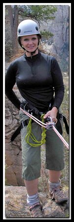
Bo Beck, a veteran on Zion's high angle Search and Rescue Team, has wrote the canyoneering reports on this site that are in and around Zion National Park. When it comes to Zion, Hiking, Canyoneering or ropes
Hard-core hikers say - "Bo Knows!" Visit my Bo Beck page to learn more about him.
|
|
Tunnel Canyon
|
1.6
|
+300
|
1
|
Hwy 9
|
Kids
|
Easy
|
Spring
|
|
Cascading Falls
|
2
|
+650
|
2
|
Hwy 9
|
Kids
|
Easy
|
Spring
|
|
Two Pines Arch
|
.81
|
+400
|
2
|
Hwy 9
|
Boulders
|
Moderate
|
Arch
|
|
Shelf Canyon
|
2
|
+100
|
2
|
Hwy 9
|
Boulders
|
Moderate
|
Slot
|
|
Separation Canyon
|
2.5
|
+400
|
2
|
Hwy 9
|
Kids
|
Moderate
|
Spring
|
|
Pine Creek Waterfall
|
.25
|
+200
|
1
|
Hwy 9
|
Boulders
|
Moderate
|
Fun
|
|
Middle Pine Creek
|
2
|
+200
|
2
|
Hwy 9
|
Boulders
|
Moderate
|
Fun
|
|
Many Pools
|
1
|
+1442
|
2
|
Hwy 9
|
Kids
|
Moderate
|
Spring
|
|
Hidden Gardens
|
2
|
|
2
|
Hwy 9
|
Kids
|
Moderate
|
Slot
|
|
Hidden Arch
|
2
|
+200
|
2
|
Hwy 9
|
Kids
|
Moderate
|
Arch
|
|
Clear Creek
|
2
|
|
2
|
Hwy 9
|
Kids
|
Moderate
|
Slot
|
|
Gifford Canyon
|
3
|
+200
|
2
|
Hwy 9
|
Boulders
|
Moderate
|
Wash
|
|
Checkerboard Arch
|
4
|
+270
|
5
|
Hwy 9
|
Kids
|
Moderate
|
Arch
|
|
Jug Handle Arch
|
2.4
|
+650
|
4
|
Hwy 9
|
Boulders
|
Moderate
|
Arch
|
|
Eagle Crags
|
4.8
|
+650
|
4
|
South
|
Horse,K
|
Moderate
|
BLM
|
|
Huber Wash
|
4
|
+310
|
3
|
South
|
Horse,K
|
Moderate
|
Winter
|
|
Scoggins Wash
|
11
|
+934
|
9
|
South
|
Horse
|
Moderate
|
Winter
|
|
Coalpits Wash
|
14
|
+834
|
9
|
South
|
Horse
|
Moderate
|
Winter
|
|
Chinle Trail
|
16.4
|
+50
|
10
|
South
|
Horse
|
Moderate
|
Winter
|
|
Deertrap Mountain
|
20
|
+1170
|
10
|
Hwy 9
|
East Rim
|
Strenuous
|
View
|
|
Cable Mountain
|
16
|
+1048
|
10
|
Hwy 9
|
East Rim
|
Strenuous
|
View
|
|
Checkerboard Mesa
|
2
|
+600
|
4
|
Hwy 9
|
Scrambling
|
Strenuous
|
Summit
|
|
East Temple Saddle
|
2.25
|
+1100
|
4
|
Hwy 9
|
Scrambling
|
Strenuous
|
View
|
|
Progeny Peak
|
1.2
|
+1075
|
3
|
Hwy 9
|
Scrambling
|
Strenuous
|
Summit
|
|
Spry Canyon
|
2
|
+700
-1050
|
6
|
Hwy 9
|
Scrambling
|
Strenuous
|
Petroglyphs
|
|
Cockeye Falls
|
4.5
|
+/-925
|
6
|
Hwy 9
|
Scrambling
|
Strenuous
|
View
|
|
Parunuweap Pass
|
5.2
|
+1150
|
8
|
Hwy 9
|
Scrambling
|
Strenuous
|
View
|
East Fork
Virgin River
|
8.6
|
+/-1650
|
10
|
Hwy 9
|
Scrambling
|
Route Finding! Very Strenuous
|
Slot
Powell Plaque
|
|
Mt. Kinesava
|
2.5
|
+2812
|
2.5
|
South
|
Scrambling
|
Route Finding! Very Strenuous
|
Petroglyphs
|
|
Mountain of the Sun
|
7
|
+1526
|
10
|
Hwy 9
|
Scrambling
|
Route Finding! Very Strenuous
|
Summit
|
|
Bridge Mountain
|
10
|
+1056
|
16
|
Hwy 9
|
Scrambling
|
Route Finding! Very Strenuous
|
Arch
|
|
Lady Mountain
|
1.3
|
+2440
|
8
|
Hwy 9
|
Scrambling
|
Route Finding! Very Strenuous
|
Summit
View!
|
Mineral Gulch
Meadow Creek
|
19
|
+1100
-4400
|
19
|
Hwy 9
|
Scrambling
|
Route Finding! Very Strenuous
|
Slot
|
|
Technical Hiking and Canyoneering
|
|
Zion's Peak Bagging
|
Route Finding
Technical
|
Summit
|
|
|
Route Finding
Technical
|
Canyons
|
|
More Hiking in and Near Zion National Park
|
|
Kolob Hiking
|
Various
|
|
Winter Hiking
|
Various
|
|
Hiking to Water
|
Various
|
|
Backpacking in Zion
|
Overnight
|
|
Greater Zion Area
|
Various
|
|
|
[South of Zion's South Entrance] [Cliff-side: Exposed scramble or ledge] [Slot: Slot or Narrows]
[Boulders: Climbing over boulders or up steep slabs] [Semi-Tech: Rope and climbing skills]
[ Scrambling: Hiking/Climbing up or down steep slick rock]
[Technical: Advanced climbing or canyoneering]
For more hiking information - To ask questions of Bo Beck and Mary Cisneros, as well as other's like Tom Jones, Joe Braun and Ram, who have spent a great deal of time hiking, climbing and canyoneering in Zion, join either or both of the following online outdoor chat groups.
Disclaimer & Privacy Policy
All rights reserved © Copyright Zion National-Park dot com
Do not use photos or maps without permission © Zion National-Park dot com
|
|
All Zion Trails
Best Zion Trails
Zion Topo Map
Zion Canyoneering
Zion Canyon Hiking - Usually from April 1st until October 30th Zion Canyon is accessed via the shuttle. Private cars are allowed in Zion Canyon the rest of the year. Park at the Zion Canyon Visitor Center to ride the shuttle.
Kolob Hiking - There are two sections of the park called Kolob, one by Cedar City, Kolob Canyons, and another near the small town of Virgin, Kolob Terrace.
|