For those with limited time on a busy agenda, wishing to stretch their legs before visiting the unique Coral Pink Sand Dunes State Park, and yet desiring to see a wonderful arch in Southern Utah, the arch at the dunes is a definite must see! It is a very short drive and even shorter walk to see this natural wonder, nestled in the pinions and junipers just off Hancock Road on the way to the State Park.
People don't think of an arch when they think sand dunes or pictographs either, but the Coral Pink Sand Dunes has both. This is a varied park with a lot of different adventures. It's a good teaching moment for children to learn hos arches are created. Neary Zion has several arches even though that's certainly not what it's known for.
Photo Album:Arch Pictures Trail Maps:Topo Map Day Hike: Yes Distance: 350 yards. Average Hiking Time: .25 hours Difficulty: Easy. Trailhead: Hancock Road Trailend: Same as trailhead. Trail Access: Year-round. Off the Beaten Path: yes Best Season: Year-round.
Driving Directions From Utah Highway 89, just a little over 9 miles south of Mt. Carmel Junction, or almost 7 miles north of Kanab is the south entrance to Coral Pink Sand Dune State Park via Hancock Road. Turn west off Highway 89 and travel .8 mile and look for a road that turns right (north) and steers toward a large hoodoo. Drive about 150 yards and park at the base of the 60' high hoodoo. Because this area is so accessible it may have evidence of neglect, so please, if possible gather any trash that may have accumulated there.
The Arch - Locate the road that travels northwest just below and walk about 75-100 yards down the road and look for a spur ATV track on the right. Walk approximately 100 yards north on this spur to arrive at two rock outcrops on hikers left. The second outcropping is about 18' tall and is the location of the arch. The rock is about 30' wide, 15' tall and has an opening in the middle that can be walked through. This would be a good spot to get out of the sun, take a break and have a snack before continuing on to the park.
Parking
37°08.666 N
112°35.011 W
Arch
37°08.747 N
112°35.070 W
Directions to the Coral Pink Sand Dunes State Park Plan your Coral Pink Sand Dunes Vacation with our
Utah Maps and Information
Coral Pink Sand Dunes from Zion National Park
From Zion National Park. Exit Zion Park through the east entrance and drive 12 miles to the junction U-9 & US-89. This is Mount Carmel Junction. Turn south on US-89. Turn-off to the sand dunes 3 miles from Mt. Carmel Junction. Follow Yellow Jacket road for 8 miles to the Coral Pink Sand Dunes State Park. Lodging for Coral Pink Sand Dunes
Coral Pink Sand Dunes from
Utah Highway 59 & Arizona 389
From Hurricane, Utah take Utah 59 to Arizona 389 just past Colorado City look for the road leading to the Coral Pink Sand Dunes. It will come out 3 miles from Mt. Carmel Junction, Utah. Do not travel through the dunes when it's been raining or the roads are wet from snow.
Coral Pink Sand Dunes through Fredonia, Arizona
From Hurricane, Utah take Utah 59 to Arizona 389 and travel to Fredonia, Arizona, then to Kanab, Utah. Drive on US Highway toward Mt. Carmel Junction, turning at the signed entranced to the Coral Pink Sand Dunes.
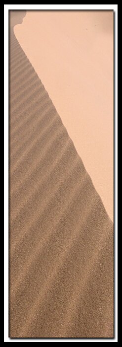
A dune of sand at the State Park
Lodging and services are available on the gorgeous east side of Zion National Park, where guests are close to Zion National Park (12 miles), Bryce Canyon National Park (60 miles), Cedar Breaks National Monument (45 miles), Coral Pink Sand Dunes (12 miles), and the North Rim of the Grand Canyon (85 miles). It's where city traffic is absent and the skies are bright and clean.
Mileage from
Mt. Carmel Jct.
Zion National Park 12
Bryce Canyon 60
Grand Canyon 85
Cedar Breaks 45
Grand Staircase 9
Dixie Forest 22
Sand Dunes 11
Coyote Butte 57
Red Canyon 47
Tuweep 90
Stay in the heart of the parks, Mount Carmel Junction, and visit the treasures of the Southwest and Utah.
This is my new favorite quote:
"I don't know who Mary Cisneros is, but I mean zionnational-park.com
It's a better site than the NPS's anyway."
Written by the authors of the book: Favorite Hikes in and around Zion National Park


 For those with limited time on a busy agenda, wishing to stretch their legs before visiting the unique Coral Pink Sand Dunes State Park, and yet desiring to see a wonderful arch in Southern Utah, the arch at the dunes is a definite must see! It is a very short drive and even shorter walk to see this natural wonder, nestled in the pinions and junipers just off Hancock Road on the way to the State Park.